Old-fashioned caching at it’s finest — an entire day out on the roads and the trails and just one smiley to show for it. That was the plan and that’s pretty much how it played out too.
Our target was a cache called “GET OUT…and enjoy the outdoors #1 – Plateau Mtn“, hidden by a cacher known as WESTSTEVO. It was originally hidden in September of 2006 and had only been found eight times over the last nine years. I think the description from his cache page says it perfectly:
“The cache is hidden on top of Plateau Mountain which is in the Highwood area of South Kananaskis Country. The route is an easy uphill walk along a gas well access road. The terrain is alpine tundra with sweeping views in every direction, including unique patterns of rocks at the summit. Elevation is 2524m and can be very windy given the open slopes. The approach roads are closed for winter access Dec.1-Apr.30.”
By 08:30 I was out the door and on the road.
BearGPS and I met in Turner Valley at 09:30. We piled Tucker the Dog and my hiking gear into his Liberty and we set off down Highway 22 and over “The Hump” to get to the start of the road leading up the mountain. Bypassing multiple caches along the way, we stayed focused on the goal, which was this cache.
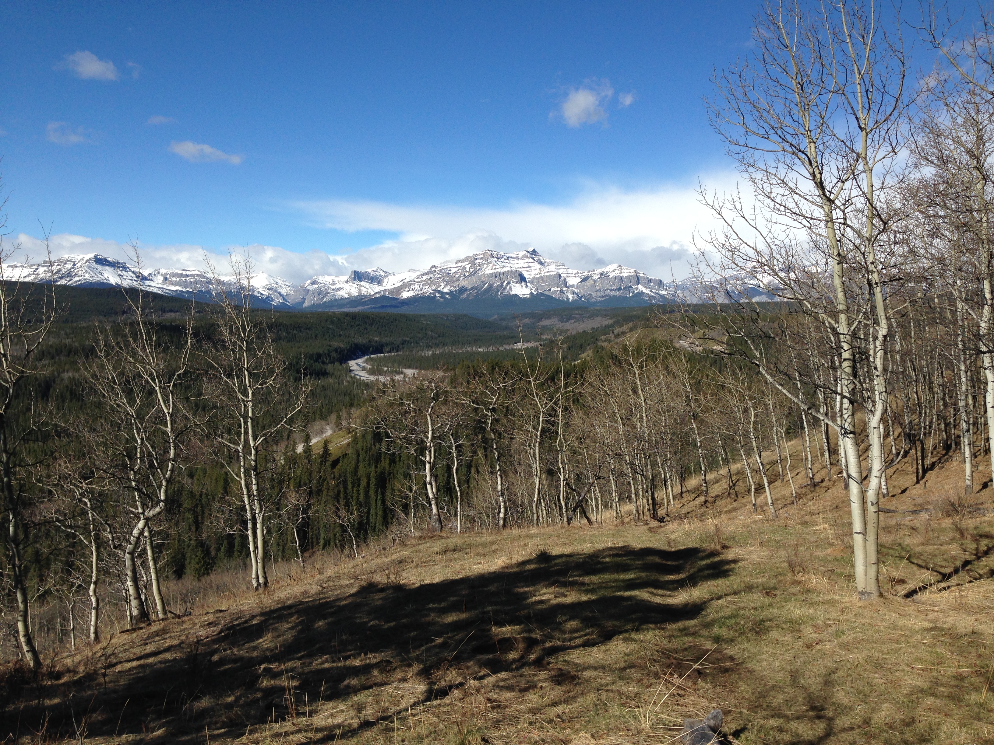
We were very happy the gate at the bottom was open so we were able to drive several kilometers up the mountain to the same parking spot VDD used several years ago. Stashing the car we set off on foot up the road, admiring the views of Pasque Mountain across the valley and making plans for a future caching trip.
Once the road curved we were finally able to get a good look at the target, which seemed deceptively simple. What’s a couple hundred meters of elevation, right? We saw some sections of road that were washed away from the floods of 2013, but the road is very well-maintained and one could easily get a car up here if not for the pesky locked gate.

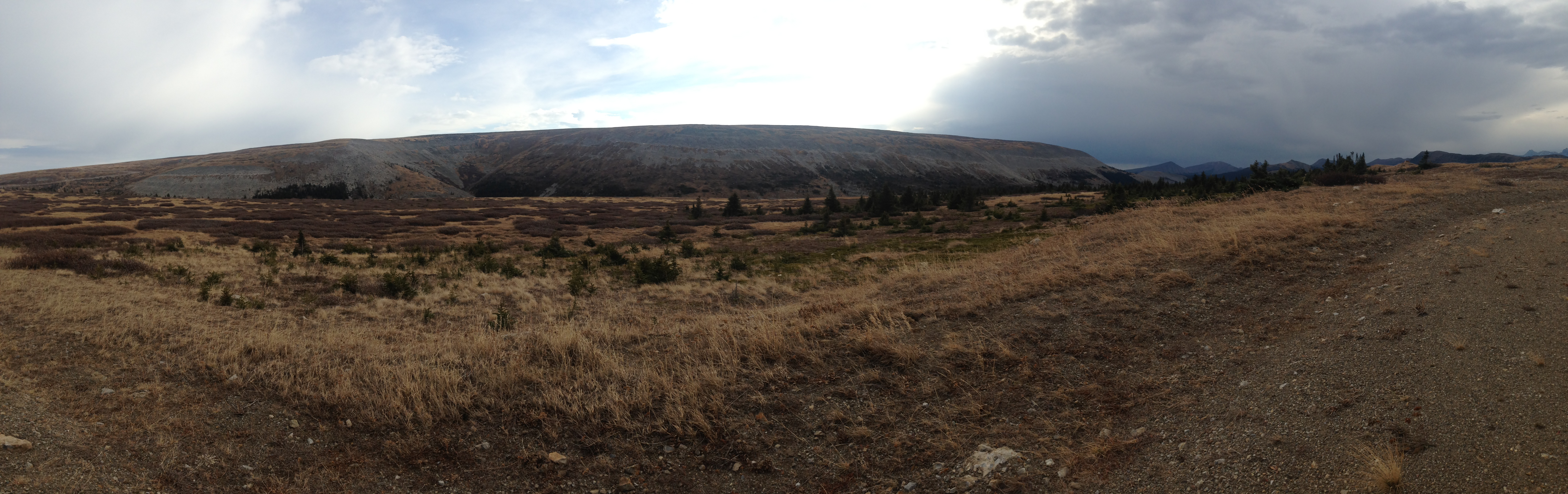
Plateau Mountain as seen from the gas well road
We finally left the road and started wandering across the rocks and grass, hopping from “island” to “island”. The rocks are remarkably stable so it was easier going than you would expect. We were soon at the rim and as it came into view I let out a few exclamations that can’t be repeated on a family cache page. It was remarkable and one of the best “view to effort ratios” I’ve ever experienced on a cache.

This gas well road will be your constant companion on this hike.
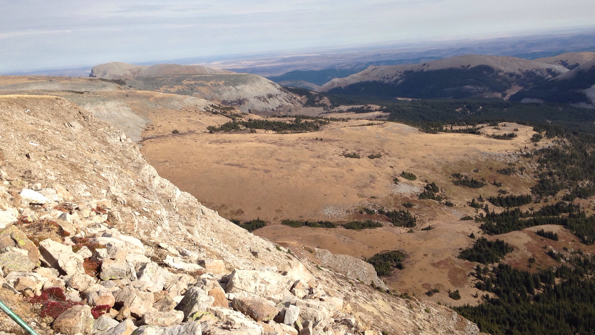
After sitting idle for three years, we were worried if the cache would still be in place but it was there — perfectly tucked away and in excellent shape. We took some photos, signed the log, and then continued exploring the rest of the plateau. Holy crap, once you’re up here it really is flat! We walked further to the southern end, past the gas plant and towards the radio tower before heading back down. The wind was a little chilly and sometimes annoying, but nothing we couldn’t handle.

The view from the cache site — looking northward
On the way down, beyond the switchbacks, we ran into the only other person we would see all day — a lone hiker with his dog. We chatted briefly and he asked us some questions about the trail while consulting Gillean Daffern’s trail guide.
Before long we were back at the Liberty. The fellow we saw had made it up the gas well road to the locked gate in a Chrysler Sebring, so I can be fairly confident I could get the Rondo up here when I decide to make a return trip.
Of course, Tucker found something nasty to roll in just before we got back to the vehicle. Oh man, did he stink!
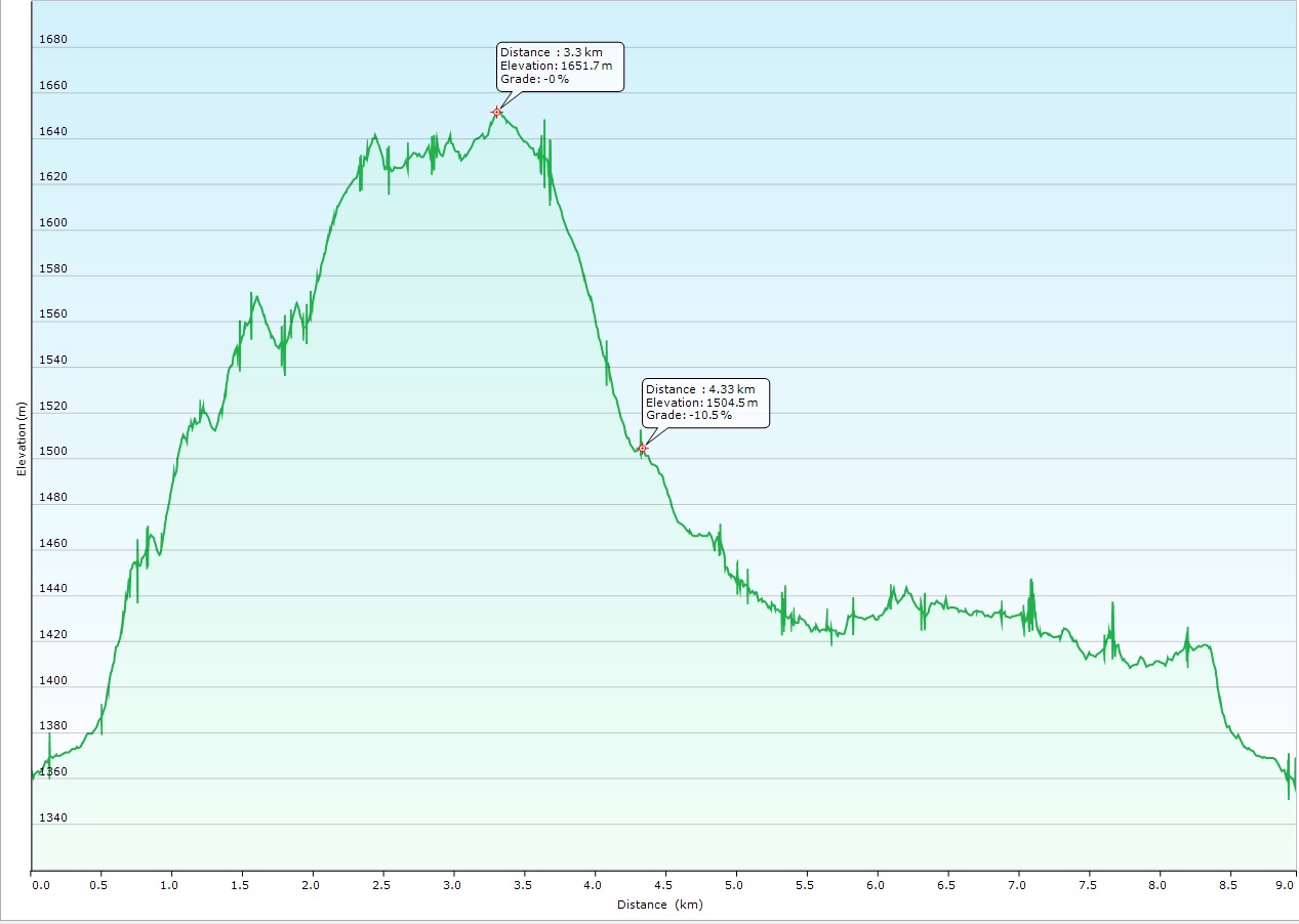
Our round trip distance was about 12km. If you don’t explore the southern part of the plateau, you can likely shave 3km off that total. (Personally, the best views are on the north end so don’t feel like you are missing out if you don’t go all the way.)
Rather than going back over The Hump, we decided to turn right at the bottom of the gas well road and follow the gravel past Cataract Creek and Etherington Creek campgrounds. We drove with the windows down, taking advantage of the 15C temperature and keeping us from having to smell too much of the dog. Back in Turner Valley, we unloaded the Liberty and we set off for our respective homes, with Tucker and I following BearGPS in the Rondo. We turned off at Millarville to head up Highway 762 while he carried on northwards on 22.
It was when I got to the junction of Highways 762 and 22 that I realized I had left my wallet tucked under the front seat of the Liberty. Crap! Making a hard right I detoured into the city to his house to grab my wallet. A quick stop for a couple of ingredients for tonight’s dinner and I was back on the road to Cochrane, finally getting home a little after 7pm. A memorable day!
Some final comments and thoughts:
- You can park at the locked gate which saves a lot of elevation. Aim for these coordinates: N50 13.536 W114 33.308
- The hike itself is entirely along the gas well road. The views are what make this cache worthwhile; the hike itself is pretty mundane.
- WESTSTEVO hid 14 Geocaches between 2006 and 2008, including four in his “GET OUT…and enjoy the outdoors” series. I found two of the other caches in this series, one in 2007 and one in 2009. WESTSTEVO doesn’t appear to have logged into Geocaching.com since 2011. Five of his caches are still active.
- This is an isolated area and cell coverage cannot be counted on, although we did have excellent service at the summit. Be prepared! All standard hiking rules apply — bring proper gear, let someone know where you are going and when you are expected to be back, bring water and a variety of clothes because the weather can change quickly out here.
50.217736
-114.537917