Dance the Night Away in Saskatchewan

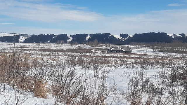
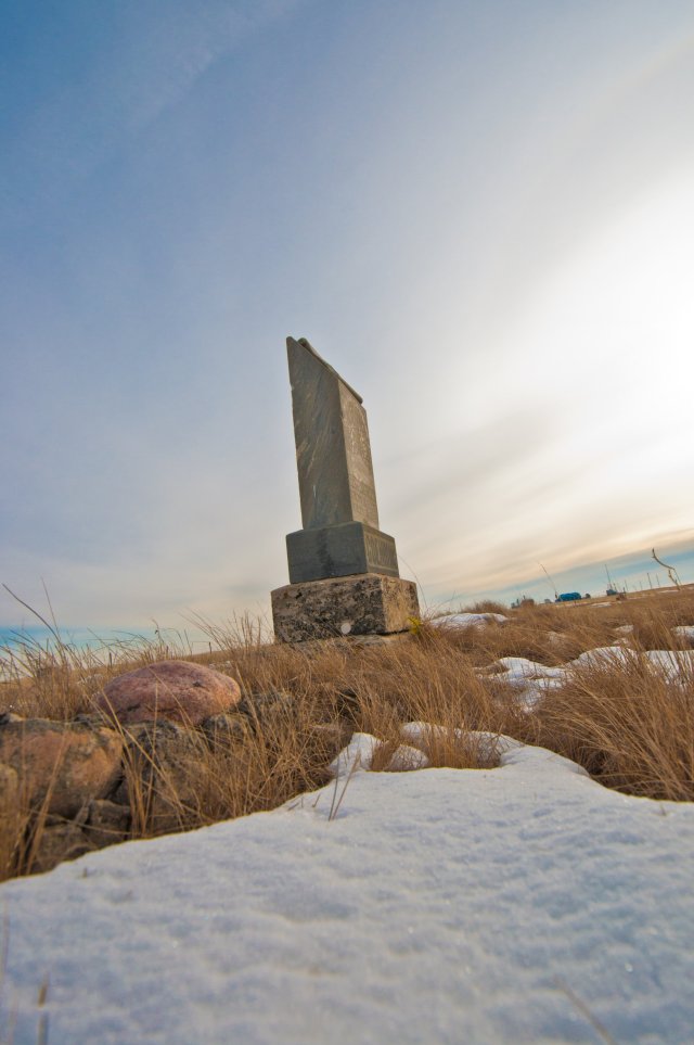
Manitou Beach is a tiny village located on the south shore of Little Manitou Lake.  In the first few decades of the twentieth century, this was an extremely popular tourist destination thanks to the “miracle” waters of Little Manitou Lake.

In reality, the miracle is simply a function of geology.  The lake basin was carved by glaciers and several springs in the lakebed release mineral-laden waters into the lake.  The lake does not have any natural outlets so the minerals simply build up and give the water a unique composition of minerals such as sodium chloride, magnesium sulphate, potassium sulphate, and calcium sulphate, and others.    It has been nicknamed “the Dead Sea of Canada” thanks to the purported healing qualities of the water and the density of salts which makes it easy to float in it.

Emily and I have had the opportunity to visit Manitou Beach on several occasions between 2012 – 2017, usually for purposes of visiting the Manitou Springs Resort.  That was the primary purpose of our day trip of December 27th, 2017 when we set out from Saskatoon for Manitou Beach.

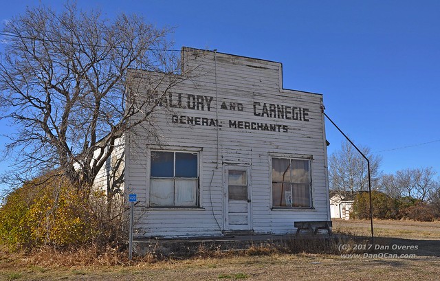
However, no trip with us would be complete without at least one stop for some quirky roadside attraction.  On this day it was a sign proclaiming Young, SK as the home of the “World’s Largest Freestanding Mural”.  It caught our attention on the way to Manitou Beach but it was only on the way back when we took time to check it out up close.

Young, SK

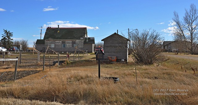
Our first thought was that the sign had been vandalized, but the spray paint marks were simply covering up the words “Coming Soon”.  (Photo courtesy of Emily Overes)

The artwork on the mural is very well done and highlights the history of Young and area.  We’re not really sure if anyone validated the “world’s largest” claim or not, but we’re thinking maybe the inclusion of “freestanding” as an adjective limits the competition.  Regardless, the mural is 20′ high and 80′ long or roughly 6m x 24m for those who think metric, which I guess I should considering this is Canada.  The mural was originally painted in 2012 and was going to be mounted on the side of the ice rink but the size of the artwork meant the town couldn’t verify the integrity of the building so it was instead set up as a freestanding mural instead.

Young, SK

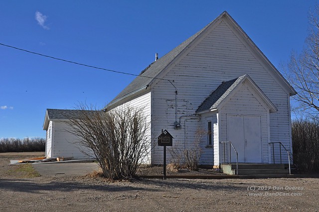
Once in Manitou Beach, we had to stop in and check on Danceland.  Danceland really is the main focus of this posting — way to bury the lead, eh?

Construction of Danceland started in 1928, which would have been right at the peak of the tourist boom in Manitou Beach.  Reports are the first dances were not held until 1930.

Danceland is unique because of the construction of the dance floor itself.  It actually consists of two floors — a solid floor and a floating floor, with a layer of horsehair in between.  Several inches thick, the horsehair gives the floor a unique bounce and allows dancers to go all night without tiring as much as they would on a traditional floor.  It is reported that the floor will actually bounce about and inch-and-a-half when under full load, which is often 500 people.  The dance floor covers an area of 5000 sq. feet.

Danceland

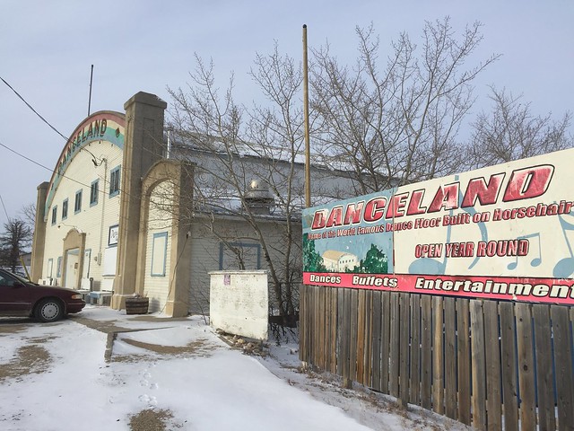
Exterior photo of Danceland taken by Emily Overes.  December 27, 2017

Danceland1928

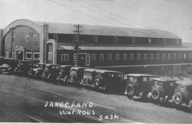
Danceland in 1930.  Source:  Ruth Schellenberg, retrieved from http://www.watrousheritage.ca/ManitouBeachPictures.php 


Danceland

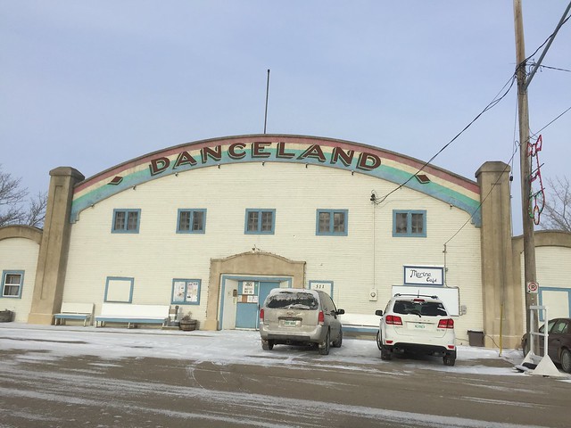
Danceland with some slightly more modern vehicles in front.  Image from Emily Overes, December 27, 2017

Danceland

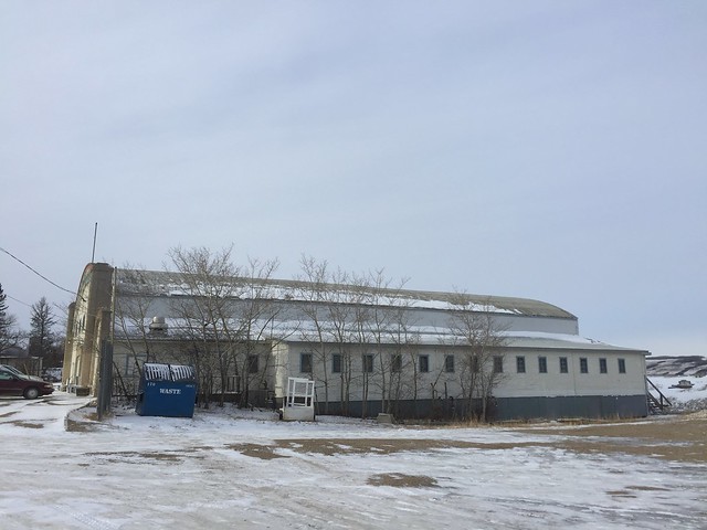
Photo by Emily Overes.  December 27, 2017


Inside Danceland

Interior photo of Danceland.  Taken by Emily Overes (nee Giesy) in July of 2012

Danceland Pamphlet

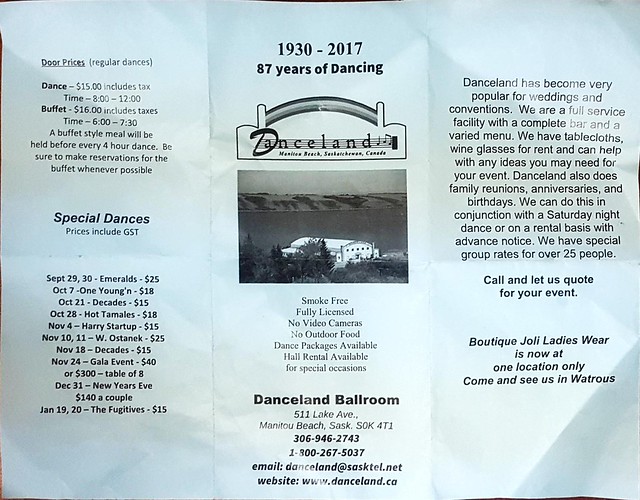
Pamphlet for Danceland.  2017

Heritage buildings are under constant threat, and Danceland is no exception.  In this case, the very water that brought the people to Manitou Beach and made Danceland possible is the biggest threat to the building.  With no outlets, Little Manitou Lake is very much at the mercy of nature when it comes to water levels.  In 2011, a large berm was needed to keep the flood waters at bay.  During our first visit in July of 2012, the owners had portable pumps set up and were desperately trying to keep the foundation dry.

It was during that visit we were lucky enough to get inside and see the famous dance floor for ourselves, but we have yet to actually make it to Manitou Beach for one of the dances.  It shall remain one of our exploration bucket list items for now.

I had wanted to shoot some drone footage of Danceland but the cold weather and a tight schedule put those plans on hold.  So, instead check out this short video made by Tourism Saskatchewan and learn more of the history of Danceland.

Sources:

Schellenberg, R. M. (1996). Lake of the healing waters: Manitou Beach, Saskatchewan, Canada. Watrous, Sask.: Star Books.
Wrishko, M. (2017, August 26). Saskatoon Online – Village of Young Unveils New Mural. Retrieved March 24, 2018, from http://www.sasknow.ca/local-news/village-of-young-unveils-new-mural
Danceland. (n.d.). Retrieved March 24, 2018, from http://danceland.ca
Posted in History, Travel | Tagged , , , , , , , , , , | 1 Comment

20 Years of Exploring

Sometimes a posting comes together quickly.  I’ll get an idea for a topic, throw something up on the screen, and publish within an hour or so.  Other posts take a long time to come to fruition.

This is one of those latter type of posts.  If you don’t want to know the gory details of how it came together, I’ll put the video right up here near the top for you.

The idea was simple.  With all the snow we’ve been getting this Spring, I had plenty of time to sit down in front of the computer and look through thousands and thousands of images and try to select some favorites for inclusion in a retrospective slideshow.  Hmm, when I actually say it that way it sounds rather daunting, but it seemed simple at the time.

When that process was done, I loaded the pictures into Wondershare Filmora and started building the slideshow.  I expected this part to come together quickly, but that project sat open on my desktop for three or four weeks.  Out of every YouTube video I have created, this one took the most hours to actually complete.

The first problem was I had too many images.  Even at only a few seconds for each one, the video would have ended up being way too long for anyone to actually watch.  I started dumping images.  I went through many rounds of cuts.  It was at this point I also decided to drop any plans of including drone footage and instead focus completely on still photographs.

The next question was around style.  Should I include only “artsy” photographs or pictures which I consider to be some of my best?  What about all those photos that Emily and I have nicknamed “documentation shots”?  Those are the photos where we’re passing through a place and don’t have time to stop so we just point and shoot so we have some record of the places, knowing many of them will not be there the next time we come by again.  I left in a mix of all types, including some from when I was in my “HDR the hell out of everything” phase.

Then it was the ordering of the images.  I started chronologically, with some of the oldest photos being scans of shots I took on film back in 1997.  As I built that storyboard, I realized I was losing a big part of the story.  One of the great things about exploring for so many years was seeing the changes in the places I have visited multiple times over the years.

For example, Dorothy.  Some of the oldest images I have on my computer are from my initial trip to Dorothy circa 1997.  (Since I didn’t scan the images until several years later, I don’t know the exact date but that is my best guess based on context.)  The churches in Dorothy were in horrible shape when I first saw them.  Since then they have undergone an amazing restoration and look nothing like the shells they once were.  Meanwhile, the grain elevator has continued to deteriorate.  I think it is an incredible visual story, but just putting the images in chronological order meant that narrative was lost — too many subjects came into play between the 1997 Dorothy images, the 2006 Dorothy images, the 2011 & 2012 Dorothy images, and the 2017 pictures.

So, I scrapped the whole thing and started again, this time basing the order on locations instead of time.  All the Dorothy images were together, allowing one to see the changes that two decades can bring to a ghost town.  But then I found the video lost a sense of discovery.  If all the images of Dorothy are together, there is no sense of anticipation over what will come next.  Plus, some of the places where I only had images from one visit seemed out of place — what’s the point in focusing on telling the story of an evolution if you’re not going to carry that theme all the way through?

Scrap the whole thing and start again.

I finally settled on a general theme based on the type of building.  You’ll see the video front loaded with grain elevators, then move into service stations, then churches and schools, and other old businesses.  Given those themes and trying to fit the whole thing to the piece of music I selected meant dropping more images.  Old cars?  Gone.  Abandoned houses?  Gone.  Old buildings that aren’t really abandoned?  Gone.  Well, mostly gone.  There are a couple of places that survived those cuts such as the grain elevators in Nanton, which are far from abandoned.  Some of the photos I simply liked too much to leave out.

Of course, those themes went under multiple revisions too.  Maybe mixing themes was too much?  Instead of one four minute video maybe I should create four one-minute videos each with a unique theme?  Nah, stick with it and see where it goes.  By this point I was just trying to get this thing done and off my screen.

And, finally, subtitles.  I originally wanted to highlight the year the photo was taken and the location.  I also wanted to mention which locations no longer existed and how/when they were lost.  I went through many revisions on this idea and many styles of fonts and lettering, trying to find something that worked.  In the end, I decided to drop the subtitles completely.  I found they distracted too much from the photos and giving away all the details takes away some of the mystery.

So, after all that, I invite you to scroll back to the top and take a journey with me through time and place.  We’ll travel from 1997 to 2017 with multiple stops in between.  We’ll see highlights from three provinces and even one photo from Montana that made it into the mix.  You may question some of my selections, but each of these photos has some meaning to me.  Whether it was the place, the time, the people…there is likely a thousand word story behind every photo.  If any of them pique your interest, please tell me in the comments as I would love to give you more context.


Posted in History, Photography, Travel | Tagged , , , , , , , , , , , | 1 Comment

Glenbow Ranch Provincial Park

So close to home, yet a world away.  That’s the best way I can think to describe Glenbow Ranch Provincial Park.  Located just south of Highway 1A between Calgary and Cochrane, once you leave the pavement it is hard to imagine you are sandwiched between a town of 25,000+ and a city of more than a million people.

The written history of the land upon which the park is built really starts in 1881 when the federal government granted a large-scale grazing lease to the Cochrane Ranche Company, which was headed by Senator Matthew Cochrane of Montreal.  The ranch covered 109,000 acres with its main buildings built beside Big Hill Creek in what is now the town of Cochrane.  The ranch would last until 1888 when it was sold for division into homesteads.

During the years of the Cochrane Ranch, the area saw the coming of the Canadian Pacific Railroad.  After reaching Calgary in August of 1883, the railway would make steady progress until reaching Banff just weeks later.  The line followed the Bow River valley, which provided a steady source of water for the crews and the steam engines.  Today, 135 years later, the railway still runs the same course and trains are a common sight, although we didn’t see any during this visit.


DSC_5714

The CP mainline continues westward to the mountains and Pacific coast.


After the Cochrane Ranch sold off the land, a couple of the homesteaders to arrive in the area were Joseph and Elizabeth Cockbaine of England.  They laid claim to a section of land in August of 1893 and began the process of building on and improving the land.

Three years later, the Cockbaine family had built Waverley Ranch.  In addition to a house and outbuildings, they had 22 cattle, seven horses, and 2000 sheep.  When Joseph applied to the Land Office for a Letter Patent, he learned he had actually developed the wrong piece of land.  The Government overlooked the mistake and granted him title to the property in 1897.  Today, only the chimney from the Cockbaine’s ranch house remains, standing in the field just south of the pathway, fenced off in a protected area.  It was this chimney which was our target of today’s hike.


DSC_5712

The Waverly Chimney is inside a protected area.  All photos used in this posting were taken from public pathways.


This isn’t the only history in the park.  The CPR had established a railway station at Glenbow by 1903.  Between the years of 1907-1912 a sandstone quarry was established at what is now the east end of the park.  After the quarry closed a brickyard opened in the same area.  While there were great plans for the town of Glenbow to grow into a major urban centre, it simply did not occur and the town declined throughout the 1920s until the last residents moved away in 1927.

There are only a couple of buildings which remain from the town of Glenbow.  The most known is the former general store and post office, which remains in the park.  Like the Waverley Chimney, it is fenced off and in a protected area with no public access, although it is visible from the pathway.


The second building which remains is the old Glenbow schoolhouse.  It was moved out of the valley and today stands just north of Highway 1A and has been converted into a private residence.

After the demise of Glenbow as a town, the land continued to be used as private ranchland.  The Harvie family purchased the land in 1934 and it remained in their hands until 2006 when they donated 3246 acres to the Government of Alberta for the establishment of a park.

Glenbow Ranch Provincial Park officially was designated in April of 2008 which kicked off a number of developments which were needed before the park could be opened to the public.  These included washrooms, picnic tables, pathways, signage, and a designated railway crossing.  It was not until the summer of 2011 before Glenbow Ranch Provincial Park was open to the public.

Since then, I have made multiple visits to the park in all seasons.  Two of those visits over the last three days formed the basis of this posting.  The park offers a variety of paved and dirt pathways and boasts nearly 25km of trails.  The area retains ties to its cattle grazing history and at various times during the year some areas may be closed as cattle are moved around or graze different sections.


DSC_5716

All land along train tracks remains the private property of CP Rail and access is prohibited.

Glenbow Ranch Provincial Park is open year-round during daylight hours.  No campfires or horseback riding.  Dogs must be leashed.  Obey all area closures.  

Sources:
Atlas of Alberta Railways. (n.d.). Retrieved March 11, 2018, from http://railways.library.ualberta.ca/Chapters-7-1/
Cochrane Ranche. (n.d.). Retrieved March 11, 2018, from http://www.historicplaces.ca/en/rep-reg/place-lieu.aspx?id=11541
Glenbow Ranch Provincial Park. (2017, July 4). Retrieved March 11, 2018, from https://www.albertaparks.ca/parks/kananaskis/glenbow-ranch-pp/information-facilities/history/
Posted in Hiking, History | Tagged , , , , , , , , , , | Leave a comment

Flashback: Alderson 2010

Another in my series of lunch break postings from my phone…

I remember the first time I visited Alderson. It was exactly eight years ago today.

Armed with my “just over a year old” Nikon D90 (the same camera I still use), I came upon the mostly empty field where Alderson once stood.

Only a couple of buildings remained, along with some discarded buckets and just the faintest outline of a grid of streets.

The town was known as Carlstadt until the anti-German sentiment caused by World War I brought about the name change to Alderson.

The day of my first visit was somewhat windy but not overly cold. A layer of snow blanketed the ground. It was somewhat dreary, if truth be told. Of course the conditions were nothing as bad as the harsh conditions the residents of Alderson faced during its heyday.

Alderson was expected to be the “Star of the Prairies”, the major centre for miles around. Mother Nature had other plans and by the end of the 1930s it was all over for Alderson. Fires, harsh winters, and crippling drought would see the Star of the Prairies disappear.

On that initial visit I photographed everything in black and white. Given the light, the barren landscape, and the history of the location, it just seemed appropriate.

A subsequent visit in 2012 brought both color to my images as well as a more detailed exploration of the small Alderson cemetery located just east of the townsite.

It was my visits to Alderson which sparked my desire to learn more about the history of the TransCanada Highway. Prior to that first visit I never knew how many times the TCH was realigned in its relatively short history. The old alignment, which in this area ranges from well-maintained gravel road to nothing more than two dirt tracks in the grass, has created a desire to one day create a series of films documenting the history of the road. While it may not have the romance and history of the USA’s Route 66, the TCH is our “mother road”. It is a story told in multiple books, but one which I think needs to be told in a more visual medium.

Anyway, lunch is almost over so I need to wrap up this posting. The townsite of Alderson was the victim of a fire in 2015 (?) which eliminated the remaining buildings shown in my photos. (The buildings may have been destroyed before the fire, but I’m not sure.)

A prairie fire was a fitting end to the remains of Alderson. I highly recommend reading the 1987 book “Empire of Dust” by David Jones to learn more.

Posted in History | Tagged , , , , , , , | Leave a comment

Lethbridge Road Trip: October 2017

I think I’m finally catching up on my photos and items that I have wanted to post.  That is more a product of colder weather and staying close to home more than it is any sort of increase in productivity.

I had almost forgotten about these images which were taken last October on our way home from Lethbridge.  I was cleaning up some folders on my computer when I stumbled across these sitting in my “Import” folder on the hard drive.

One of the challenges about making the same trip many times over the years is finding new routes to travel and other ways to keep the drive from becoming too routine.  While revisiting familiar places over the course of many years and watching them change and evolve can be fun too, the possibility of seeing something for the first time just can’t be beat.  This trip had a good mix of both.

There’s not much to say about this trip, other than sit back and let the pictures tell the story.

DSC_5551

An abandoned farm north of Picture Butte

DSC_5553

Dusty roads and wide open prairie make for some great vistas


DSC_5554

Checking out a wind farm south of Travers Reservoir

DSC_5556

Since 2015 I have been keeping a list of all the “Alberta Break” grain cars we see.  This section of track in Champion was a mother lode.


DSC_5558

Champion Inn, Champion, AB

DSC_5559

This old service station has seen better days but isn’t so far gone that it couldn’t be brought back to life


DSC_5560

Another old service station in Champion

DSC_5561

This service station, also in Champion, appears to be of a slightly newer vintage and has been nicely maintained.  It would appear Champion had no shortage of places to get fuel back in the day.


DSC_5562

I didn’t notice in person, but looking at the photo more closely reveals words such as clothes, groceries, boots, and shoes in the old paint.  I always thought this was an old hotel, but perhaps it was a general store with living quarters upstairs?

DSC_5563

Probably one of the most-photographed buildings between Calgary and the US border.  The iconic gas pump which stood out front for many decades is no longer present but I learned via a Facebook group that the building’s owners removed it to protect it from thieves.


DSC_5564

The Kirkcaldy school (1925 – 1953)

DSC_5566

The Ensign school (1912 – 1954) is now a private residence


DSC_5570

The Brant grain elevator


Posted in History, Travel | Tagged , , , , , , , , , , , , | Leave a comment